WHEREAS on April 18, 1952, the Tennessee Valley Authority and the United States Department of Agriculture entered into an agreement (designated as a supplemental agreement of transfer) providing for the transfer by the said Authority to the said Department of the right of possession and all other right, title, and interest which the Authority might have in or to certain lands therein designated and described in Cherokee County, North Carolina, so that such lands might be included in and reserved as part of the Nantahala National Forest, in accordance with the terms and conditions of the said agreement and subject to the approval thereof by the President of the United States; and
WHEREAS I have this day approved the said agreement between the Tennessee Valley Authority and the United States Department of Agriculture; and
WHEREAS it appears that such lands are suitable for national-forest purposes and that the inclusion of such lands in the Nantahala National Forest would be in the public interest:
NOW, THEREFORE, by virtue of the authority vested in me by section 24 of the act of March 3, 1891, 26 Stat. 1103, and the act of June 4, 1897, 30 Stat. 34, 36 (16 U.S.C. 471, 473), and as President of the United States, and upon the recommendation of the Secretary of Agriculture, I hereby include in and reserve as part of the Nantahala National Forest the following-described lands such inclusion and reservation to be in accordance with and subject to the terms and conditions of the said agreement of April 18, 1952, between the Tennessee Valley Authority and the United States Department of Agriculture:
PARCEL No. 1
Beginning at US-TVA Monument 72-3 (Coordinates: No. 549,301; E. 447,817) at a common corner of the lands of the United States of America (US-TVA), the U.S. Forest Service, and Gay Hawkins et ux; thence with the United States of America's (US-TVA) boundary line N. 2 deg. 27' E., 2077 feet to a stone; thence N. 88 deg. 27' E., 1737 feet to a U.S. Forest Service monument; thence N. 7 deg. 42' W., 492 feet to a metal marker at the top of a ridge; thence with the top of the ridge as it meanders in a northeasterly direction approximately 1475 feet (straight line bearing and distance of N. 48 deg. 07' E., 1407 feet) to a metal marker; thence, leaving the ridge, S. 1 deg. 14' W., 1165 feet to US-TVA Monument 2-1; thence S. 54 deg. 26' W., 1659 feet to US-TVA Monument 72-7; thence N. 14 deg. 20' E., 335 feet to US-TVA Monument 72-6; thence N. 86 deg. 56'W., 1177 feet to US-TVA Monument 72-5; thence S. 6 deg. 31' W., 1808 feet to US-TVA Monument 72-4; thence S. 84 deg. 55' W., 136 feet to the point of beginning, and containing 46.9 acres, more or less.
PARCEL No. 1
Beginning at US-TVA Monument 7-1 at a corner in the boundary between the lands of the United States of America (US-TVA) and the U.S. Forest Service from which the most northerly corner of the above-described Parcel No. 1 bears S. 1 deg. 14' W., at a distance of 1386 feet; thence from the point of beginning with the United States of America's (US-TVA) boundary line S. 1 deg. 14' W., 505 feet to a metal marker; thence N. 41 deg. 55' W., 313 feet to a metal marker; thence S. 52 deg. 09" W., 1300 feet to a metal marker; thence N. 7 deg. 42' W., 1227 feet, passing a metal marker at 1088 feet, to a metal marker; thence S. 85 deg. 48' E, 750 feet to a metal marker; thence N. 31 deg. 23' W., 726 feet to US-TVA Monument 7-2; thence N. 71 deg. 07' E., 82 feet to US-TVA Monument 6-1; thence S. 52 deg. 32' E., 1213 feet to the point of beginning, and containing 27.5 acres, more or less.
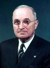
HARRY S. TRUMAN
THE WHITE HOUSE,
June 4, 1952
Harry S Truman, Executive Order 10357—Including Certain Lands in the Nantahala National Forest Online by Gerhard Peters and John T. Woolley, The American Presidency Project https://www.presidency.ucsb.edu/node/278668

