The White House, December 30, 1919.
In order to coordinate the activities of the various map-making agencies of the executive departments of the Government, to standardize results, and to avoid unnecessary duplication of work, I hereby constitute a Board of Surveys and Maps, to be composed of one representative of each of the following organizations:
1. Corps of Engineers, U. S. Army. 2. U. S. Coast & Geodetic Survey, Department of Commerce. 3. U. S. Geological Survey, Department of Interior. 4. General Land Office, Department of Interior. 5. Topography Branch, Post Office Department. 6. Bureau of Soils, Department of Agriculture. 7. U. S. Reclamation Service, Department of Interior. 8. Bureau of Public Roads, Department of Agriculture. 9. Bureau of Indian Affairs, Department of Interior. 10. Mississippi River Commission, War Department. 11. U. S. Lake Survey, War Department. 12. International (Canadian) Boundary Commission, Department of State. 13. Forest Service, Department of Agriculture. 14. U. S. Hydrographic Office, Navy Department.
The individual members of this Board shall be appointed by the Chiefs of the various organizations named and shall serve without additional compensation.
The Board is directed to make recommendations to the several Departments or to the President for the purpose of coordinating all map-making and surveying activities of the Government and to settle all questions at issue between executive departments relating to surveys and maps in so far as their decisions do not conflict with existing laws.
This Board shall perfect a permanent organization and shall hold meetings at stated intervals, to which representatives of the map-using public shall be invited for the purpose of conference and advice.
This Board shall establish a central information office in the U. S. Geological Survey for the purpose of collecting, classifying and furnishing to the public information concerning all map and survey data available in the several Government departments and from other sources.
All Government departments will make full use of the above board as an advisory body and will furnish all available information and data called for by the Board.
So much of the Executive Order of August io, 1906, as grants additional advisory powers to the United States Geographic Board is hereby rescinded and these additional powers are transferred to the Board of Surveys and Maps.
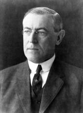
WOODROW WILSON.
Woodrow Wilson, Executive Order 3206—Constituting Board of Surveys and Maps Online by Gerhard Peters and John T. Woolley, The American Presidency Project https://www.presidency.ucsb.edu/node/350396

