Under and pursuant to the provisions of the act of Congress approved June 25, 1910 (36 Stat. 847-848), entitled "AN ACT To authorize the President of the United States to make withdrawals of public lands in certain cases" as amended by act of Congress approved August 24, 1912 (37 Stat. 497), it is hereby ordered that the land hereinafter listed be, and the same is hereby, withdrawn from settlement, location, sale, or entry, and reserved for public use in accordance with the provisions of section 10 of the act of December 29, 1916 (39 Stat. 862, 865):
Beginning at Corner No. 3, Amended United States Survey No. 375, Juneau Land District in approximate latitude 58° 18' N. and longitude 134° 24' W.
Thence from said initial point along the east boundary of United States Survey No. 375
South, 219.76 ft.;
East, 200 ft.;
South, 200 ft., to a point on the north boundary of United States Survey No. 591, 200 ft. east of Corner No. 9.
Thence along the north boundary of United States Survey No. 591
East 484.42 ft. to Corner No. 8; this corner is identical with Corner No. 1, Mineral Survey No. 926.
Thence along line 1-2 Mineral Survey No. 926, N. 61° 32' E., 600 ft., to Corner No. 2.
Thence N. 83° 42' W., 1,219.24 ft., more or less, to Corner No. 3, Amended United States Survey No. 375, the place of beginning.

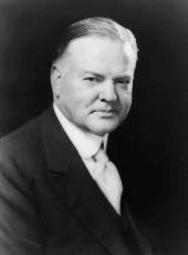
HERBERT HOOVER
The White House,
December 7, 1931.
Herbert Hoover, Executive Order 5754—Public Water Reserve No. 144, Alaska Online by Gerhard Peters and John T. Woolley, The American Presidency Project https://www.presidency.ucsb.edu/node/361321

