

Executive Order 7010—Corrected Description of the Boundaries of the Waianae-Kai Military Reservation, Hawaii
Whereas by Executive Order No. 2900, of July 2, 1918, as amended by Executive Order No. 5414, of July 31, 1930, certain lands at Waianae-Kai, District of Waianae, island of Oahu, Territory of Hawaii, were withdrawn and set aside for military purposes subject to private rights and to all public roads and rights-of-way therein, which lands comprise the Waianae-Kai Military Reservation; and
Whereas a recent survey of said reservation has revealed errors and inaccuracies in the description thereof as contained in the said Executive Orders.
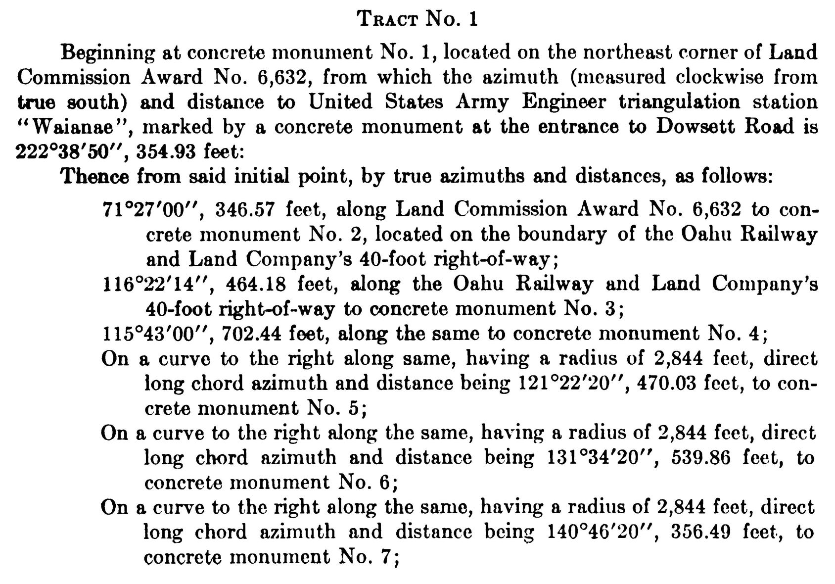
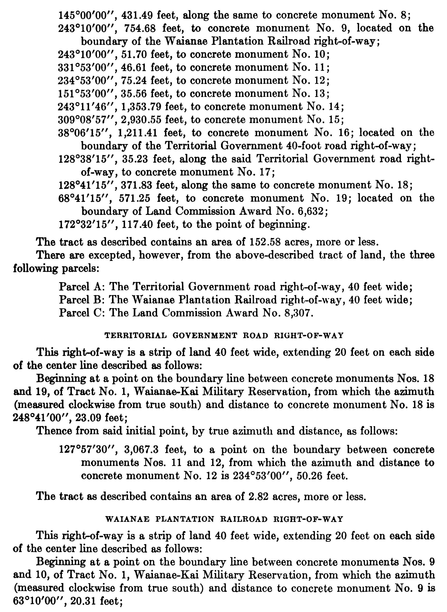
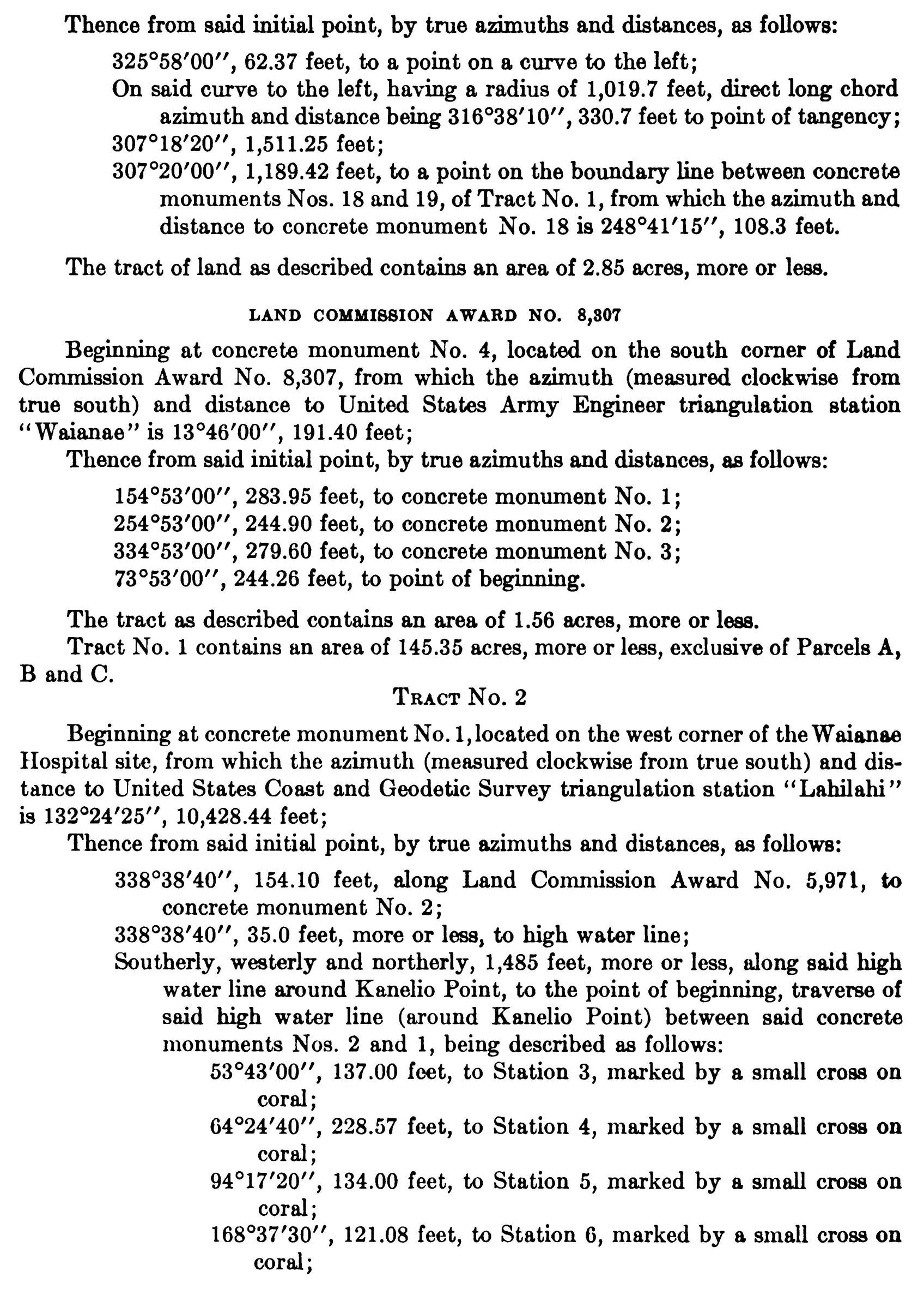
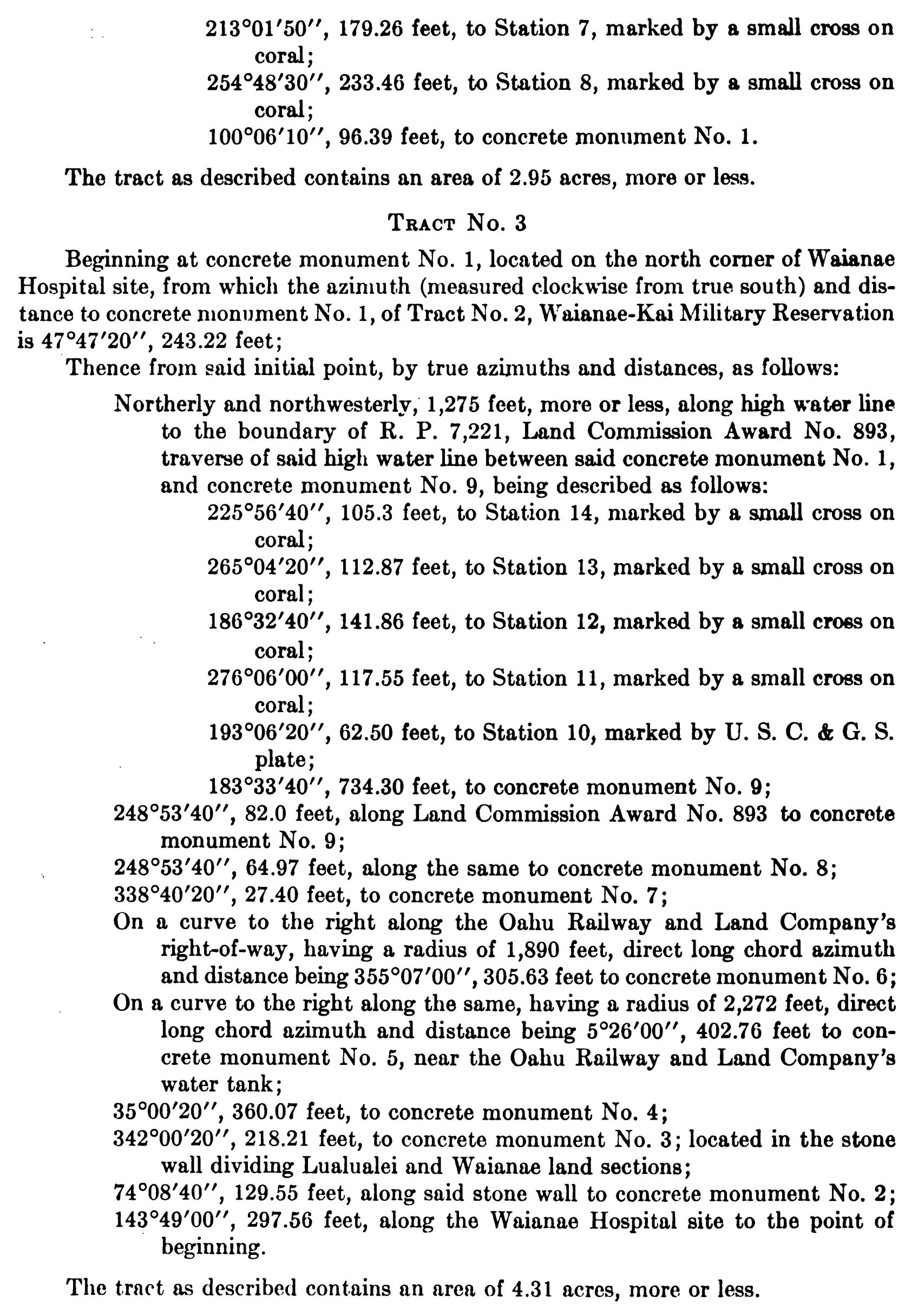
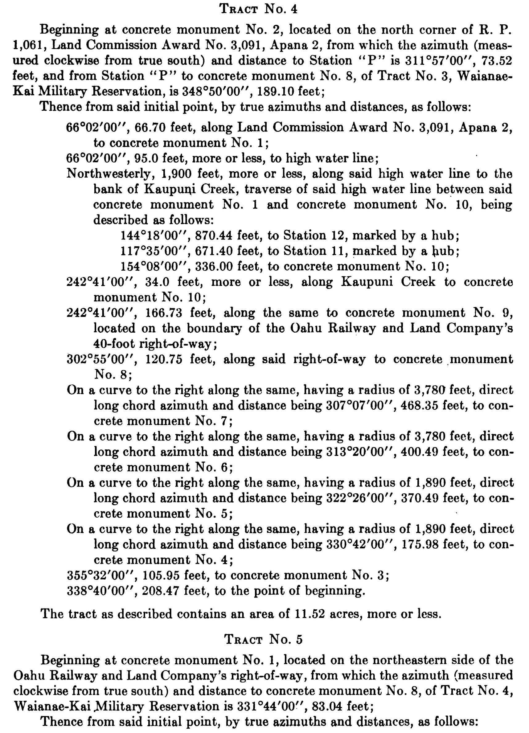
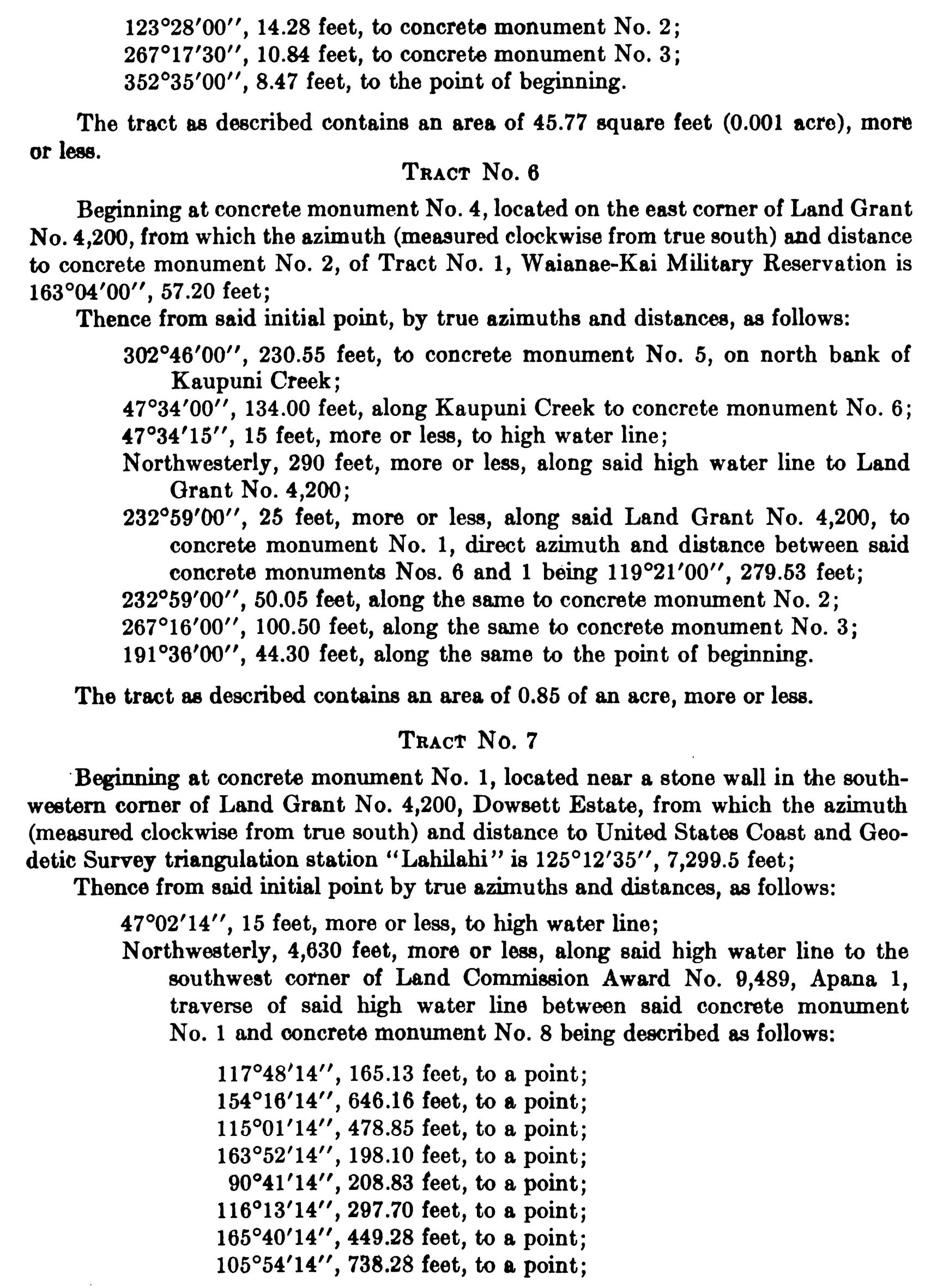
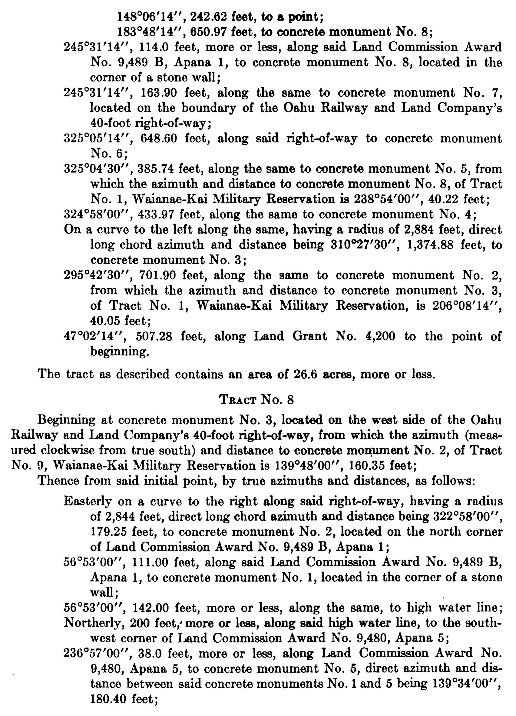
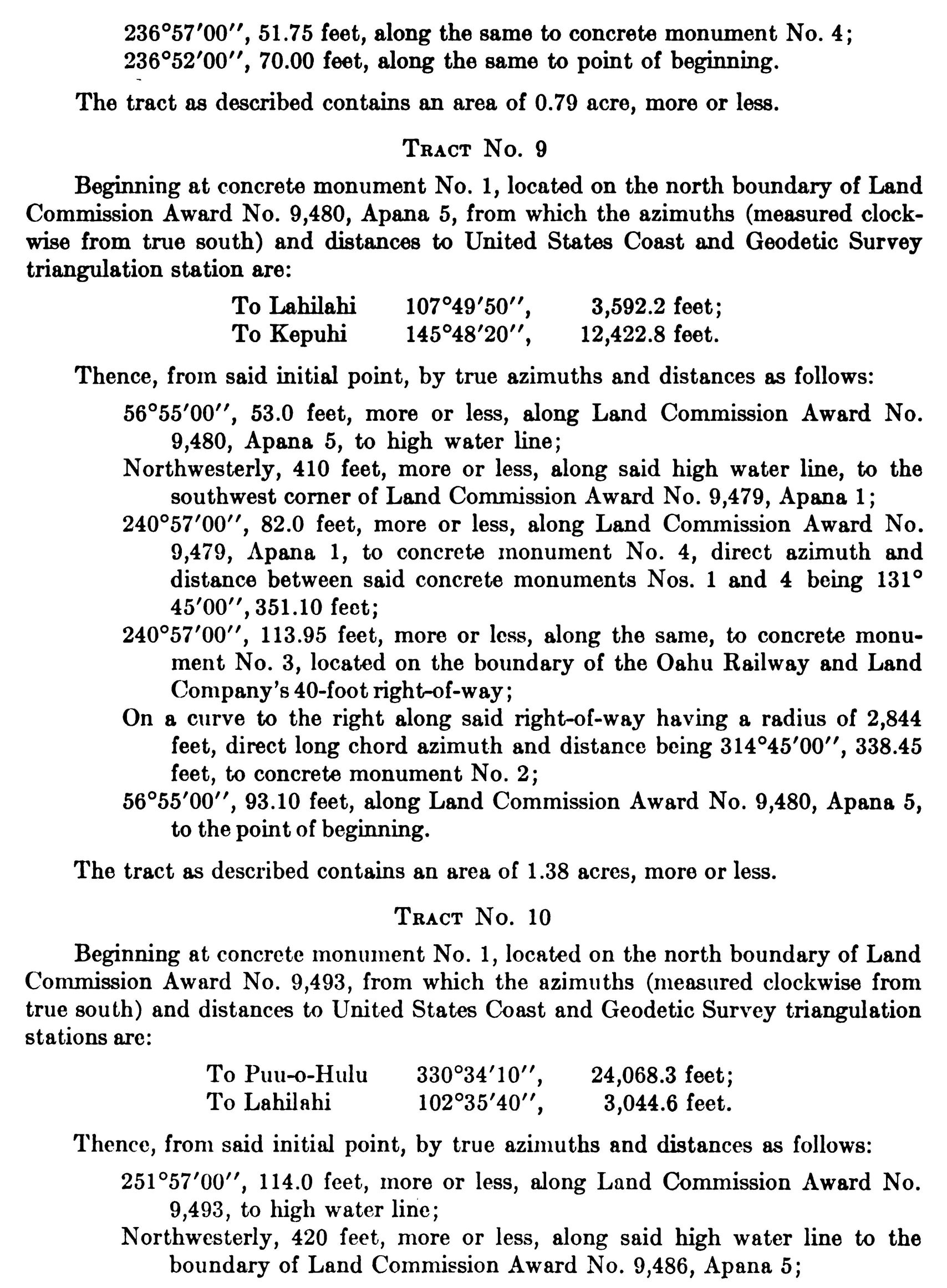
Now, Therefore, by virtue of and pursuant to the authority vested in me by section 91 of the act of April 30, 1900, 31 Stat. 141, 159, as amended by section 7 of the act of May 27, 1910, 36 Stat. 443, 447, it is hereby ordered that the description of the Waianae-Kai Military Reservation as contained in the said Executive Orders be, and it is hereby, corrected to read as follows:

FRANKLIN D. ROOSEVELT
The White House,
April 10, 1935.
Related Images
Franklin D. Roosevelt, Executive Order 7010—Corrected Description of the Boundaries of the Waianae-Kai Military Reservation, Hawaii Online by Gerhard Peters and John T. Woolley, The American Presidency Project https://www.presidency.ucsb.edu/node/376655