EXECUTIVE MANSION, October 26, 1872.
In addition to the reservation provided for by the second article of the treaty concluded January 31, 1855, with the Makah Indians of Washington Territory, it is hereby ordered that there be withdrawn from sale and set apart for the use of the said Makah and other Indians a tract of country in the said Territory of Washington, described and bounded as follows, viz.: Commencing on the beach at the mouth of a small brook running into Neah Bay next to the site of the old Spanish fort; thence along the shore of said bay in a northeasterly direction to Baadah Point (being a point about 4 miles from the beginning); thence in a direct line south (5 miles; thence in a direct line west to the Pacific shore; thence northwardly along the shore of the Pacific to the mouth of a small stream running into the bay on the south side of Cape Flattery, a little above the Waatch Village; thence following said brook to its source; thence in a straight line to the place of beginning; the boundary line from the mouth of the brook last mentioned to the place of beginning being identical with the southeastern boundary of the reservation set apart for the Makah tribe of Indians by the treaty concluded with said Indians January 31, 1855, before referred to.
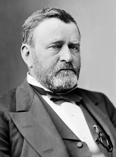
U. S. GRANT.
SOURCE: Kappler, Indian Affairs, Laws and Treaties, US GPO, 1904, p 917-918
Ulysses S. Grant, Executive Order—Drawing Boundaries for Makah Indians Online by Gerhard Peters and John T. Woolley, The American Presidency Project https://www.presidency.ucsb.edu/node/372622

