EXECUTIVE MANSION, February 7, 1879.
It is hereby ordered that the following-described tract of country in the State of Colorado, to wit: Commencing at the intersection of the 37th parallel of north latitude with the 107th degree of west longitude; thence east along said parallel to the ridge described in Hayden’s Geographical and Geological Survey of said State as the “National Divide” of the San Juan Mountains; thence following said divide in a general northerly and northwesterly direction to longitude 107 degrees and 23 minutes west; thence due south to latitude 37 degrees and 17 minutes north: thence due east to the 107th meridian of west longitude; thence south with said meridian to the place of beginning, be, and the same is hereby, withdrawn from sale and settlement and set apart as a reservation for the Muache, Capote, and Weeminuchee bands of Ute Indians.
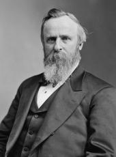
R.B. Hayes
SOURCE: Kappler, Indian Affairs, Laws and Treaties, US GPO, 1904, p 834
Rutherford B. Hayes, Executive Order—Establishment of Ute Indian Reservation in Colorado Online by Gerhard Peters and John T. Woolley, The American Presidency Project https://www.presidency.ucsb.edu/node/371282

