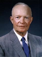
By the President of the United States of America
A Proclamation
Whereas the United States has acquired the hereinafter-described lands adjoining the Muir Woods National Monument, in California, for addition to that monument, and has also acquired, in connection with the acquisition of those lands, an easement over other hereinafter-described lands adjoining the acquired lands; and
Whereas such acquired lands and such easement are essential to the proper care, management, and use of the Muir Woods National Monument; and
Whereas it appears that it would be in the public interest to reserve such lands as a part of the monument and to reserve such easement for use in connection with the monument:
Now, Therefore, I, Dwight D. Eisenhower, President of the United States of America, under and by virtue of the authority vested in me by section 2 of the act of June 8, 1906, 34 Stat. 225 (16 U.S.C. 431), do proclaim as follows:
1. Subject to valid existing rights, the following-described lands, in California, are hereby added to and reserved as a part of the Muir Woods National Monument:
BEGINNING at a point on the easterly boundary line of Ranch "X", being a portion of Lot "D" of the Sausalito or Richardson. Rancho, situated in Marin County, California and delineated on that certain Map entitled Tamalpais Land and Water Company Map No. 3, filed in Book 1 of Maps, at page 104, Marin County Records, the field notes of which are recorded in Volume "D" of Miscellaneous Records, at page 1; said beginning point being north 16°05' West 421.93 feet from the most easterly corner of the said Ranch "X", said point being also in the northerly line of that certain 50-foot right-of-way conveyed by William Kent and Elizabeth T. Kent, his wife, to Muir Woods Toll Road Company, and recorded September 14, 1926, in Liber 102 of official records, at page 494, Marin County Records; and running thence along said right-of-way line south 75°05' west 2.69 feet; thence leaving said line north 53°18'30" west 102.25 feet, south 54°40' west 93.23 feet, north 36°38' west 63.61 feet, north 11°10' west 68.02 feet, north 36°56' west 172.17 feet, north 8°12'30" west 491.22 feet, north 38°05' east 143.10 feet to the southwesterly line of the aforesaid 50-foot right-of-way; thence along said right- of-way line on a curve to the right whose center bears south 43°27'30" west and whose radius is 275 feet, distance 14.20 feet; thence south 43°35' east 216.30 feet; thence on a curve to the left whose center bears north 46°25' east and whose radius is 425 feet distance 82.954 feet; thence south 54°46' east 77 feet; thence on a curve to the right whose center bears south 35°14' west and whose radius is 275 feet, distance 271.42 feet; thence south 1°47' west 47.90 feet; thence on a curve to the right whose center bears north 88°13' west and whose radius is 975 feet, distance 38.57 feet; thence south 4°03' west 200.76 feet; thence on a curve to the right whose center bears north 85°57' west and whose radius is 75 feet, distance 92.98 feet; thence south 75°05' west 31.43 feet to the point of beginning; containing 6.16 acres, more or less.
2. The easement acquired by the United States in and over the following-described lands is hereby reserved for purposes of ingress and egress between the existing County road and the above-described lands:
BEGINNING at a point in the northerly line of the aforesaid 50-foot right-of-way, said point being the beginning of the second course of the above description; and running thence north 53°18'30" west 102.25 feet, south 54°40' west 93.23 feet, south 35°36' east 59.51 feet to the said right-of-way line; thence along said line on a curve to the right whose center bears south 35°36' east and whose radius is 125 feet, distance 45.12 feet; thence north 75°05' east 85.68 feet to the point of beginning.
Warning is hereby expressly given to all unauthorized persons not to appropriate, injure, destroy, or remove any features of this monument and not to locate or settle upon any of the lands thereof.
In Witness Whereof, I have hereunto set my hand and caused the Seal of the United States to be affixed.
DONE at the City of Washington this eighth day of September in the year of our Lord nineteen hundred and fifty-nine, and of the Independence of the United States of America the one hundred and eighty-fourth.

DWIGHT D. EISENHOWER
By the President:
DOUGLAS DILLON,
Acting Secretary of State.
Dwight D. Eisenhower, Proclamation 3311—Enlarging the Muir Woods National Monument, California Online by Gerhard Peters and John T. Woolley, The American Presidency Project https://www.presidency.ucsb.edu/node/307920

