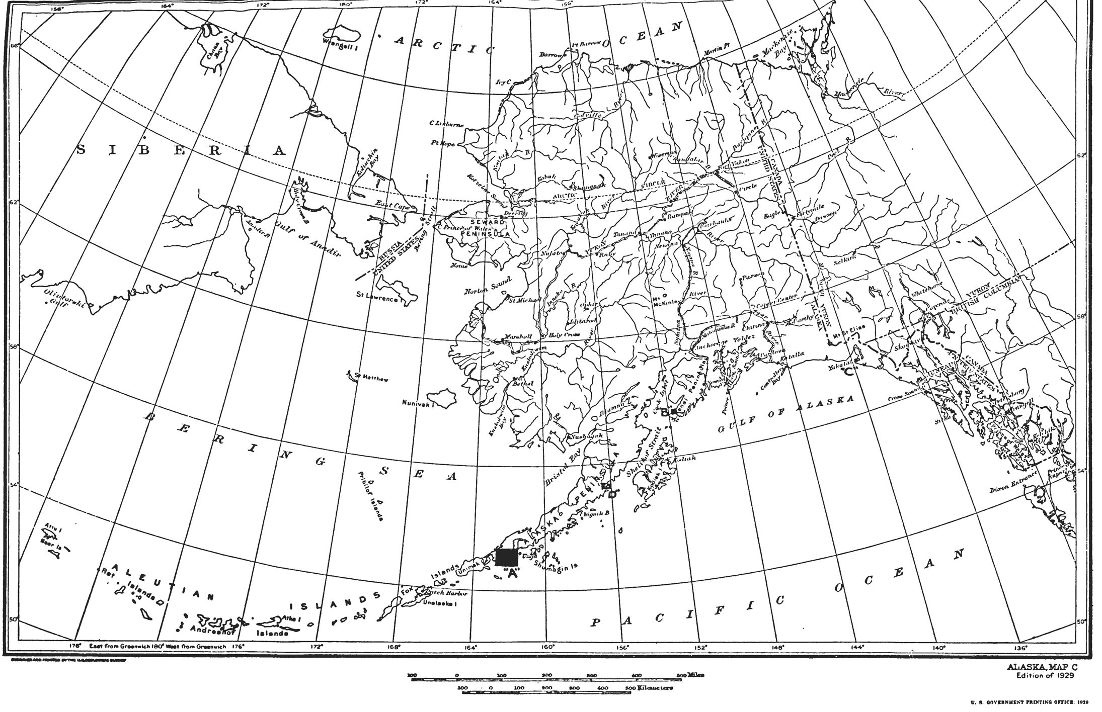
Pursuant to the authority conferred upon me by the Act of Congress approved June 25, 1910 (36 Stat., 847, Title 43, Sec. 141, U. S. Code), as amended by the Act of Congress approved August 24, 1912 (37 Stat., 497, Title 43, Sec. 142, U.S. Code), entitled “An Act to authorize the President of the United States to make withdrawals of public lands in certain cases,” and subject to the conditions, provisions and limitations of said acts, it is hereby ordered that the four unreserved hereindescribed areas of land and water in the Territory of Alaska be, and they are hereby, withdrawn from settlement, location, sale or entry and held for the exclusive use and benefit of the United States Navy Department for naval purposes until this order is revoked by the President or Congress, subject to any prior valid claim legally initiated and maintained and subject to any other valid existing rights. Said areas, designated as (A), (B), (C) and (D), and shown on the map hereto attached and made a part hereof, are described as follows:
(A) The Cold Bay-Dolgoi Island Area
All that area lying between latitude 54° 49' North and 55° 20' North, longitude 161° 38' West and 162° 44' West;
(B) The Port Graham Area
All that area lying between latitude 59° 19' North and 59° 24' North and longitude 151° 46' West, 151° 56' West;
(C) The Yakutat Bay Area
All that area lying between latitude 59° 32' North and 59° 36' North and longitude 139° 44' West and 139° 50' West; and
(D) The Wide Bay Area
All that area lying between latitude 57° 15' North and 57° 26' North and longitude 156° 01' West and 156° 35' West.

HERBERT HOOVER
The White House,
October 30, 1929.

Related Images
Herbert Hoover, Executive Order 5214—Reserving Certain Described Lands for Naval Purposes, Alaska Online by Gerhard Peters and John T. Woolley, The American Presidency Project https://www.presidency.ucsb.edu/node/360911

